


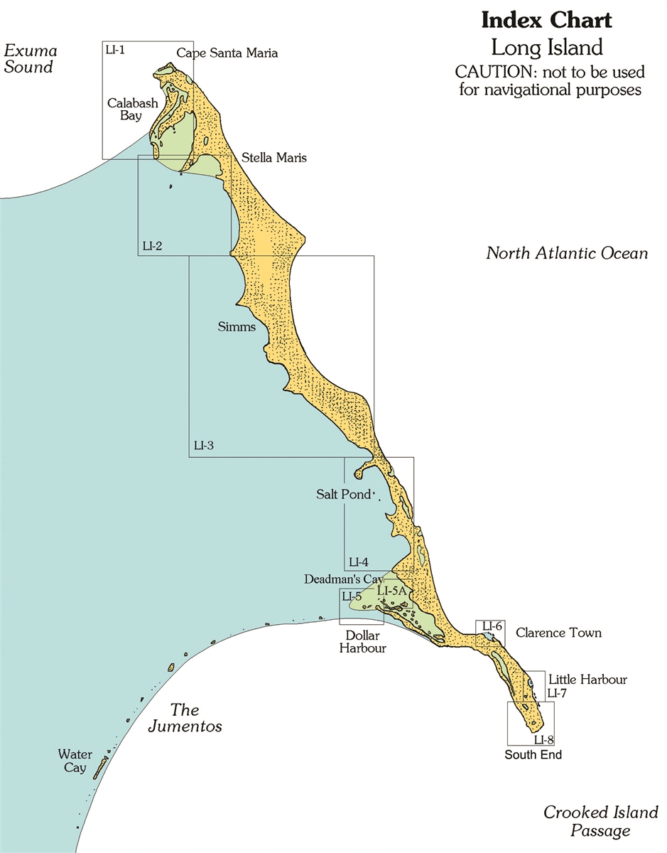

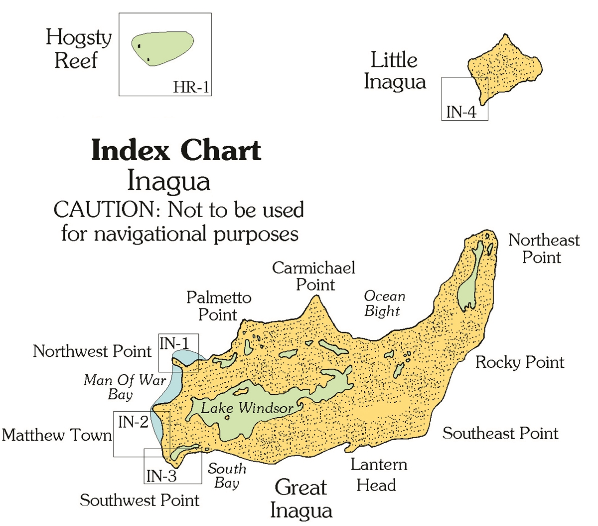
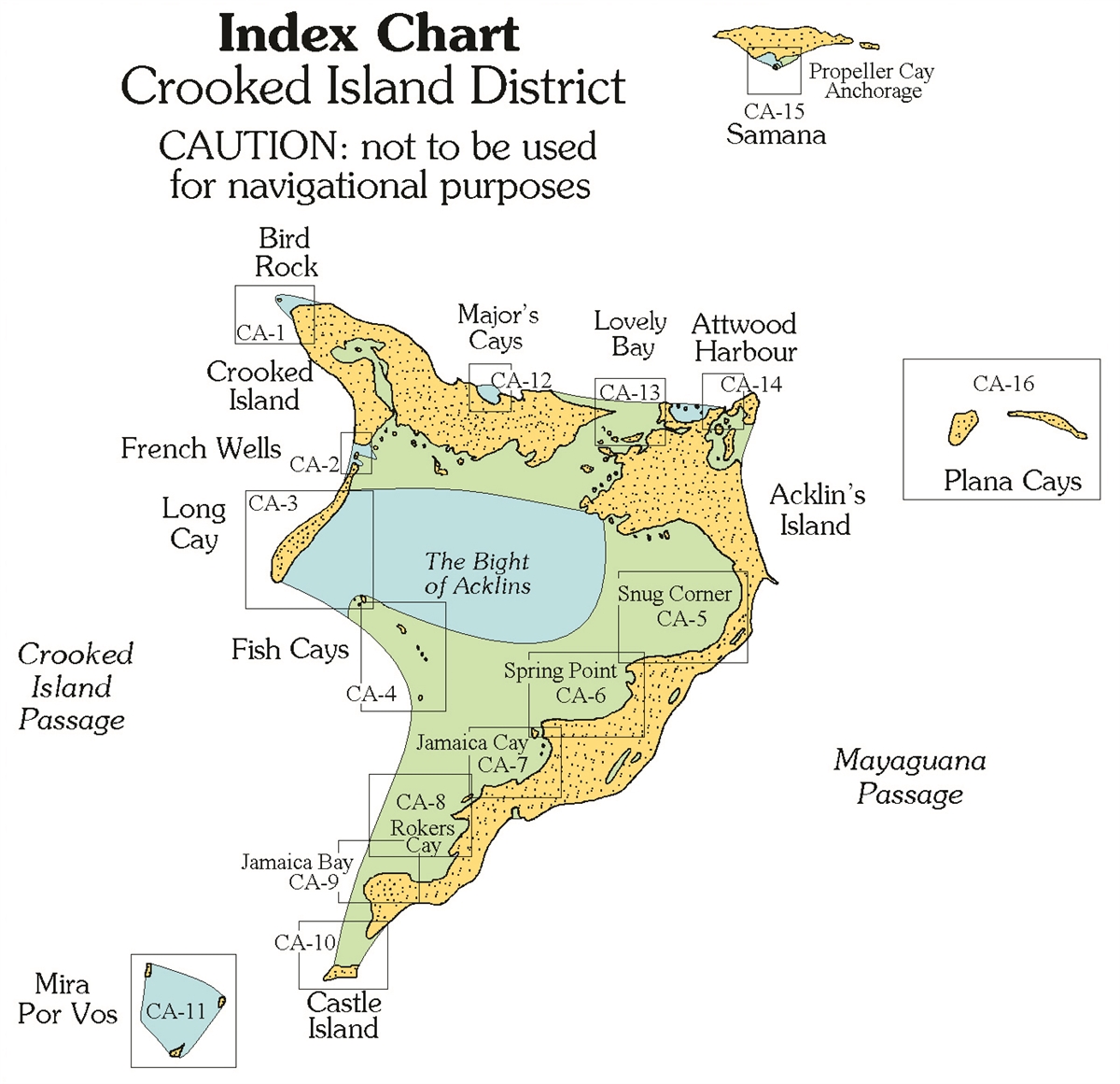
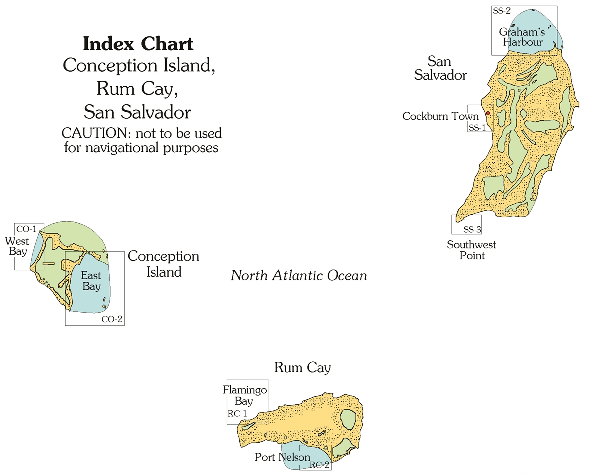
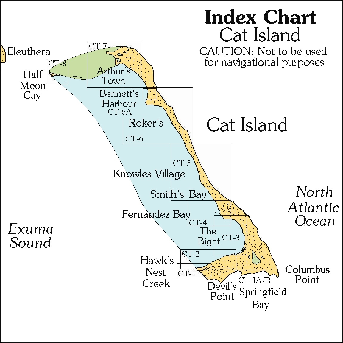
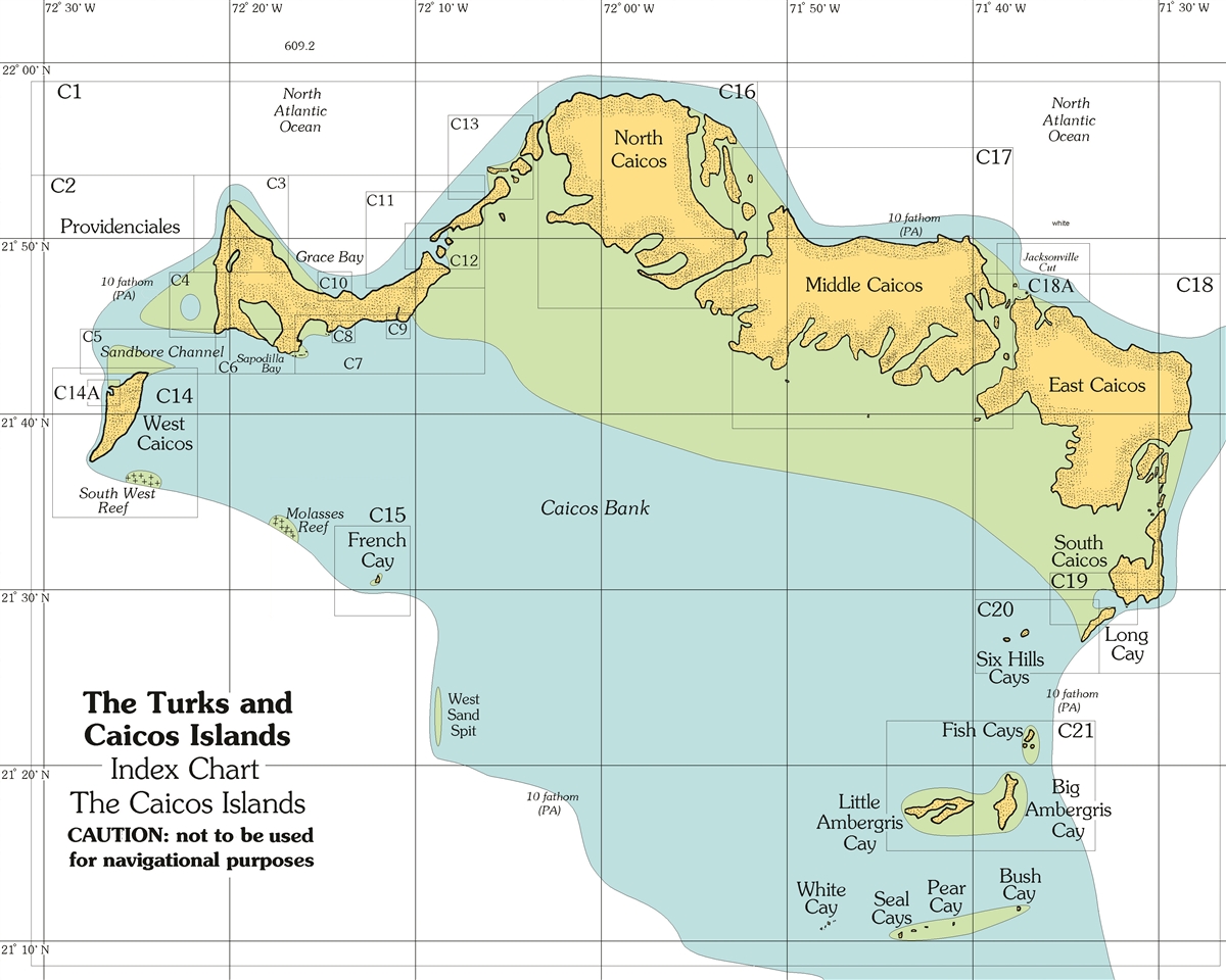


A Cruising Guide to The Southern Bahamas: from Cat Island south to the Turks & Caicos, including the Dominican Republic north coast, details the waters around Cat and Conception Islands, Rum Cay, San Salvador, Long Island, the Jumentos & Ragged Island, Crooked/Acklins, Mayaguana, Inagua, the Turks, and Caicos as well as the Dominican Republic North Coast Ports. With full-color aerial harbor photos and 100+ full-color sketch charts, it contains extremely accurate hydrographic data based on personally conducted independent surveys by the author. Southern Bahamas, Vol 2 also includes extensive navigational instructions, GPS waypoints, approaches and routes, anchorages, services, dive sites, history, basic information for cruising in the Bahamas, extensive appendices, index, bibliography, and more.
Features
- New Completely Updated Pavlidis Guide!
New Full-color Aerial Photos
All Original Charts Based on Personal Surveys Conducted by the Author
Extensive Navigational Instructions, and GPS Waypoints


Reviews
There are no reviews yet.